![Cycling Curbar Edge, England Cycling Curbar Edge, England - aerial view looking down over hillside from top of climb, blue sky, green brush covered hillside, Simon Warren's 100 Greatest Cycling Climbs #35 logo in corner]()
Cycling Curbar Edge, Derbyshire County, England
Top of climb.
![Cycling Curbar Edge, England Cycling Curbar Edge, England - photo collage, bike parked along stone fence with road sign for Curbar Lane, two lane road traveling up hillside with pastureland on side, road sign stating "Twenty's Plenty", PJAMM Cycling logo in corner]()
Number 35 on our 30 day trip through Britain documenting the 100 Greatest Cycling Climbs is Curbar Edge. The “edge” in the name Curbar Edge refers to the gritstone outcrop above (the road cuts between Curbar and Baslow edges), not the common definition of “edge” (a wall built of stone from the field being cleared for crops or pasture land which runs along the perimeter of the area cleared).
![Cycling Curbar Edge, England Cycling Curbar Edge, England - photo collage, handmade sign stating "Kill Your Speed Not Children", road sign noting that horses cross in this area, hand written sign for "Horse Manure for Sale," sign for Curbar Gap Car Park]()
This climb is steep throughout, at 10.3% average grade, and the steepest 500 meters hitting us at the very start of the climb.
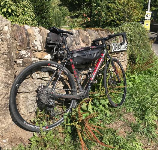
![Cycling Curbar Edge, England Cycling Curbar Edge, England - bike parked along stone fence in greenery, road sign for Curbar Lane]()
Start of climb, first 500 meters are 11.2%.
The village of Curbar (pop. 417 as of 2011) is about halfway up the climb.
![Curbar Edge #35 Simon Warren 100 Greatest Cycling Climbs, Britain stone fence with road sign for Bar Road]()
The highest home prices in Derbyshire County are on this road.
There are several popular hiking trails at the top, and a mobile cafe as well. The road is in great shape and while traffic was heavy during our ride, the vehicles we encountered traveled at a safe distance and speed.
![Cycling Curbar Edge, England Cycling Curbar Edge, England - views from above of Curbar Edge, blue sky, cars traveling along road, PJAMM Cycling logo in corner]()
The Curbar Edge.
![Curbar Edge #35 Simon Warren 100 Greatest Cycling Climbs, Britain Biking Curbar Edge #35 Simon Warren 100 Greatest Cycling Climbs, Britain - Jolly's food truck]()
Jolly’s mobile cafe at the top.
![]()
Steepest ½ kilometer begins right out of the blocks (11.2%).
The Curbar Edge climb begins in Curbar (pop. 417) is located at the eastern edge of Peak District National Park, the UK’s first national park:
“The Peak District is an upland area in England at the southern end of the Pennines. It is mostly in northern Derbyshire, but also includes parts of Cheshire, Greater Manchester, Staffordshire, West Yorkshire and South Yorkshire. An area of great diversity, it is split into the northern Dark Peak, where most of the moorland is found and the geology is gritstone, the southern White Peak, where most of the population lives and the geology is mainly limestone, and the South West Peak, with landscapes similar to both the Dark and White Peaks.
The Peak District National Park became the first national park in the United Kingdom in 1951. With its proximity to the cities of Manchester, Stoke-on-Trent, Derby and Sheffield, and easy access by road and rail, it attracts millions of visitors every year” (Peak District).
Cycling Uphill writes of this climb:
“Curbar Edge is the annual venue for the British University Cycling championships (BUCS). It is a great venue for a hill climb, with up to 300 students entering the annual hill climb. Curbar starts off with a tough 15% section, it then eases off a little. But, like many British climbs, there is no constant gradient with fluctuations making it difficult to get into a good rhythm. Towards the top of the climb on Clodhall Lane, there is a final steep section before you make it to the top. It is a tough climb to pace, with a hard section at the bottom, meaning you need to go hard, but still not too hard to blow up for the long 6 minute + climb.”

 We've partnered with Sherpa-Map.com to bring you the best route planning tool. With a PRO Membership you can use this climb as a reference when creating your route.

